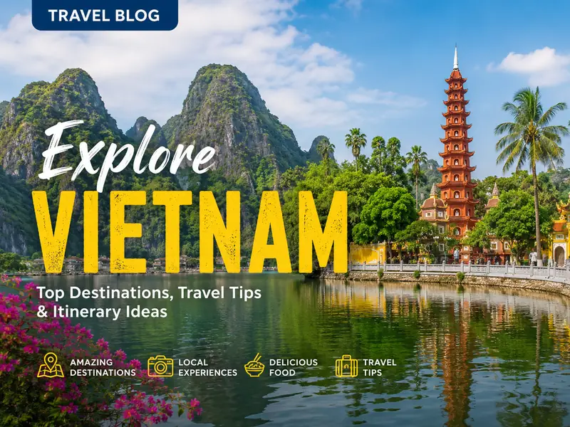
Rivers in Vietnam are more than waterways: they shape agriculture, travel routes and cultural life across the country. This article presents the major rivers you’re most likely to encounter, explains what each is known for, and offers practical information for planning visits.
What the rivers of Vietnam are and why they matter
Vietnam is crisscrossed by a dense network of waterways. Official counts put the number of rivers at around 2,360, with a combined length of roughly 41,900 km. These rivers run from upland springs to coastal deltas and have influenced settlement patterns, farming systems and historic borders.
Many of the rivers have strong regional identities: some carve dramatic limestone valleys in the north, others thread through imperial cities or form the branching channels of the Mekong Delta. They support fisheries, irrigation and local transport, and feature in local stories and seasonal rituals.
Key rivers and their highlights
The following section profiles notable rivers across Vietnam, indicating what travelers most commonly notice about each one.
Nho Que (northern highlands)
The Nho Que River runs below the Ma Pi Leng Pass in Ha Giang province. Within Vietnam its course is short—about 46 km—and much of it lies at high elevation, around 1,200 m above sea level. The river flows through deep, narrow canyons such as the Tu San gorge and is often described in poems and local songs.
Visitors report dramatic cliff-lined views from the Ma Pi Leng ridge where the water appears as a thread far below. The Nho Que provides water for the Dong Van karst plateau, where a number of ethnic minority groups cultivate rice in valley basins and corn on steeper slopes.
Ngo Dong (Ninh Binh)
Ngo Dong cuts through the Trang An-Tram An karst area in Ninh Binh province and is the main river used for boat trips to Tam Coc. The route passes rice paddies and three limestone caves that give Tam Coc its name. Boat rides typically launch from the Tam Coc dock in Van Lam village and proceed along the meandering channel to the caves.
The stretch is especially busy at harvest time, when paddies turn golden and attract photographers. For notes on local food to pair with a Ninh Binh visit, see the Ninh Binh food guide.
Huong (Perfume) River (Hue)
The Huong River crosses the city of Hue in central Vietnam and is closely associated with the city’s historical sites and court music traditions. At certain times in autumn the river is said to carry a floral scent as fallen blossoms move downstream from upriver orchards, a feature that has shaped its English name.
Many travelers choose a short boat ride in Hue to combine riverside scenery with performances of traditional songs. The river and the nearby Ngu Binh Mountain form a frequent motif in writings about the former imperial capital.
Han River (Da Nang)
The Han flows through Da Nang’s urban centre and is framed by several architecturally notable bridges. One of these—an early swing bridge in the country—helped raise the river’s profile as the city developed its evening leisure scene. A recent addition is a large wheel that adds to the nocturnal skyline.
Bridges over the Han are lit at night and the riverbanks are popular for evening walks. For planning group or corporate visits that include riverside time, consult local guides such as the Da Nang summer team trips resource.
Hoai River (Hoi An)
The Hoai is a branch of the Thu Bon River and flows through Hoi An’s historic core. Daytime activity on the Hoai reflects daily commerce and transport: small boats collect goods and passengers, while riverside streets host shops and cafés. After dark the river corridor is lit by lanterns, an image many visitors associate with Hoi An’s atmosphere.
Typical visitor options include short morning or sunset boat trips and combined cycling rides that continue toward nearby beaches—many cyclists head toward Cua Dai Beach as part of a longer local loop. Ferrymen and local guides often share stories about the town’s trading past during boat rides.
Ben Hai River (Quang Tri / former DMZ)
The Ben Hai River is historically significant because it formed part of the demarcation line between North and South Vietnam from July 1954 until reunification in 1975. The Hien Luong (Peace) Bridge crossing the Ben Hai is painted in two colors along its span and is preserved as a national monument connected to reunification narratives.
Visitors to Quang Tri and organized DMZ tours often include a stop at the bridge or a short boat ride on the river to see local scenery and memorial sites.
Son (Troc) River (Quang Binh)
The Son, sometimes called the Troc, is a tributary of the Gianh River and provides access to the entrance area of the Phong Nha cave system. Some sections of the river run underground through limestone beneath parts of Phong Nha–Ke Bang National Park.
The river’s quieter stretches pass agricultural land and small villages; the setting is often described in guidebooks as peaceful and rural. Local accounts link the Son to several regional legends, frequently about faithfulness and community histories.
Srepok River (Central Highlands to Cambodia)
The Srepok flows west from Vietnam’s Central Highlands into northeastern Cambodia, where it joins the Mekong system. It is an important waterway for several indigenous groups—reportedly more than 11,000 people from roughly nine ethnic communities—who rely on fishing, lowland rice cultivation and forest products.
The Srepok basin contains waterfalls and rapids that feature in regional ecotourism itineraries, including sites within Yok Don National Park. Visitors to the area commonly see river-based livelihoods such as fishing and may observe local children bathing or people working at riverside camps.
Mekong River (Delta and beyond)
The Mekong is the longest river in Southeast Asia and runs about 4,350 km from Tibetan-headwaters to the South China Sea. In Vietnam the river is often referred to as the Cuu Long, or Nine Dragons, reflecting its multiple distributaries across the Mekong Delta. The delta’s channels create extensive conditions for rice cultivation and floating markets.
Because the Mekong runs through six countries before reaching Vietnam, it supports a broad range of towns, ecosystems and cultural sites. River cruises on the Mekong vary in length and format; many itineraries combine onboard nights with hotel stays and overland segments, so travelers should compare overall packages rather than cruise nights alone. The high season for Mekong travel is commonly cited as November to February, when cooler, drier weather follows the rainy months from July to October.
Practical tips for visiting rivers in Vietnam
Boat trips are the most common way to experience many of Vietnam’s rivers, but conditions vary. Northern karst rivers and narrow gorges use small rowing or motorized boats; urban rivers have larger tour vessels or leisure craft. The Mekong supports both traditional sampans and multi-night river ships.
Basic practical points visitors should consider include timing (monsoon seasons affect water levels and access), local transport links, and whether a guided trip is preferable for navigation and interpretation. In many rural or protected areas, dress modestly and respect local customs when taking photographs.
- Best seasons: northern uplands can be cold in winter; Mekong Delta is driest Nov–Feb.
- Book boat tours through reputable operators in advance during peak months.
- Carry insect repellent for lowland and forested river areas.
- Bring cash for small boat operators and riverside vendors; card acceptance can be limited.
Cultural and historical context
Rivers in Vietnam are intertwined with local histories. The Ben Hai River’s role as a political boundary is one example; elsewhere rivers have shaped trade corridors, imperial precincts and spiritual practices. In many upland areas, rivers provide the freshwater terraces and valley bottoms that sustain minority farming systems.
Ethnographic diversity along river corridors is notable: communities differ in language, dress and livelihood strategies. Travelers should be aware that river visits often bring encounters with living local cultures, so observing norms and asking permission for photographs is considered courteous.
Who benefits most from river travel in Vietnam
Rivers offer a range of experiences for different travelers. Photographers and landscape-focused visitors will appreciate the karst valleys and delta mosaics. Cultural travelers often choose river routes that pass through old trading towns, temples or heritage sites. Adventure-seekers can look for rafting or trekking options near waterfall-rich tributaries such as those on the Srepok.
Families and casual tourists may prefer shorter, well-serviced boat rides in places like Tam Coc, Hue or Hoi An, where infrastructure for visitors is established and services such as refreshments, toilets and guided commentary are widely available.
Comparisons: quick reference table
| River | Region | Notable feature | Common activity |
|---|---|---|---|
| Nho Que | Ha Giang (north) | Deep canyon below Ma Pi Leng | Scenic viewpoints, short hikes |
| Ngo Dong | Ninh Binh (north) | Karst caves and rice paddies | Rowboat tours to Tam Coc |
| Huong | Hue (central) | Imperial riverscape | Cultural boat rides, music |
| Han | Da Nang (central) | Iconic bridges and riverside nightlife | Evening walks, riverbank dining |
| Hoai | Hoi An (central) | Lamps, small boats, historic town | Sunset boat rides, cycling loops |
| Ben Hai | Quang Tri (central) | Former DMZ boundary | Historical visits, short cruises |
| Son | Quang Binh (central) | Access to Phong Nha caves | Cave entrance approach, river trekking |
| Srepok | Central Highlands to Cambodia | Waterfalls, indigenous communities | Wildlife viewing, river trekking |
| Mekong | Delta (south) | Multiple distributaries; floating markets | Multi-night cruises, market visits |
Frequently Asked Questions
Which rivers are easiest for short tourist boat trips?
Rivers with regular short tours include Ngo Dong (Tam Coc), the Huong in Hue, and the Hoai in Hoi An. These routes typically offer one- to two-hour excursions that require minimal travel time from nearby towns.
When is the best time to visit the Mekong?
Many guides list November to February as a favorable period for Mekong travel because temperatures are cooler and rainfall is reduced after the monsoon season. Water conditions and market activity can vary by month, so check current local conditions before booking.
Are river areas safe to visit for independent travelers?
Most popular river routes are safe for independent visitors, but conditions differ by region. In remote upland or forested river valleys, services are limited and weather can change quickly. It is sensible to use reputable operators for boat trips and to inform hosts of planned routes when staying in less-populated areas.
Can I see floating markets on a short itinerary?
Yes. In the Mekong Delta, several floating markets operate early in the morning and can be combined with short boat excursions or day tours based in nearby towns. Timings and accessibility vary, so schedule an early departure and ask local operators about market schedules.
Do rivers support wildlife watching?
Certain river corridors are good for wildlife observation—especially sections of the Mekong and tributaries that run through protected zones or national parks like Yok Don. Waterbird, fish and small mammal sightings are common, though species presence depends on season and local habitat conditions.