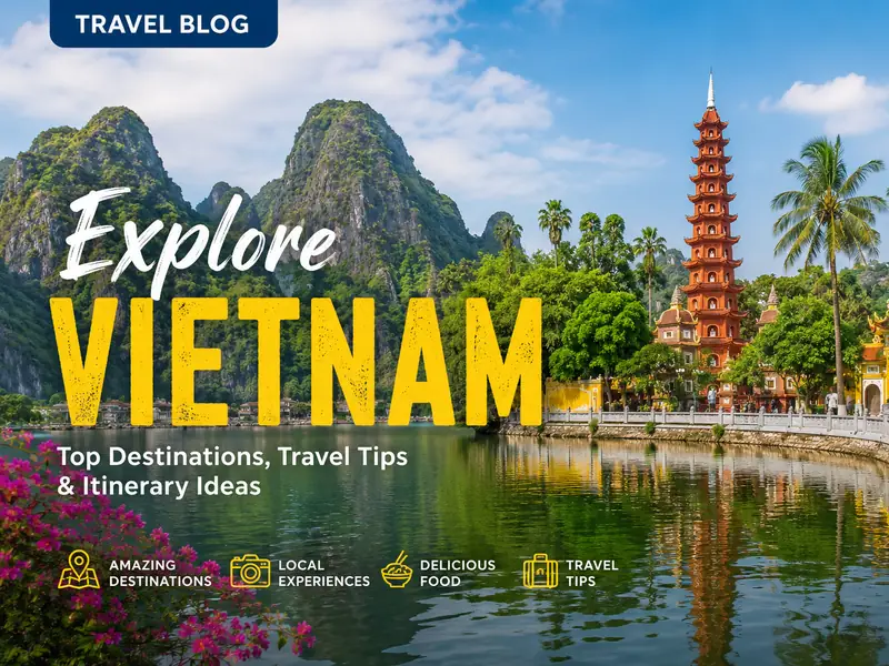
Dong Van Karst Plateau Geopark is a UNESCO-listed geological park in Ha Giang province known for extensive limestone formations, deep valleys and a rich mix of local ethnic cultures. This guide outlines the park’s origin and scale, how visitors typically reach the area, seasonal highlights and the principal places people come to see.
What Dong Van Karst Plateau Geopark is and its background
The area was formally recognised by the Global Geoparks Network in 2010, becoming Vietnam’s first geopark. The landscape sits roughly 1,400–1,600 metres above sea level and is dominated by limestone that holds fossils dating back an estimated 400–600 million years.
The geopark covers four districts — Mèo Vạc, Đồng Văn, Yên Minh and Quản Bạ — and spans about 2,356 square kilometres. Around a quarter-million people live within the geopark’s boundaries; the population includes members of some 17 ethnic groups who maintain distinct languages, dress and customs.
Key highlights and places to see in the geopark
The region’s main attractions combine geological features with cultural sites. The landscape is defined by narrow valleys alternating with rocky ridges and extensive limestone outcrops; visitors often note the area’s unusual rock shapes and exposed strata. Significant stops for many travellers include Dong Van Ancient Town, the Vuong family mansion in Sa Phin and the Lung Cu flag tower near the border.
Other notable locations inside the geopark are Sung La Valley, Ma Pi Leng Pass with views over the Nho Que River, and seasonal markets such as the weekly fair in Đồng Văn. Each site offers a different perspective — from history and architecture to river scenery and market life.
- Vuong family mansion (Sa Phin): a large, early 20th-century house with Chinese-influenced architecture and 64 rooms, located about 14 km from Đồng Văn town.
- Đồng Văn Ancient Town: a collection of older houses, some 100–300 years old, where visitors report atmospheric nights when lanterns are lit on full-moon evenings.
- Lung Cu flag tower: about 25 km north of Đồng Văn, close to the Chinese border; the modern tower is a prominent viewpoint for the district.
- Ma Pi Leng Pass and Nho Que River: a high mountain pass offering steep valley views and a ribbon-like river at the bottom; boating and kayaking are reported as possible on the river.
- Sung La Valley and Lung Cam village: known for flower gardens and buckwheat blossoms; Lung Cam has a small number of long-established households and traditional houses.
Practical tips for planning a visit
Ha Giang city is the usual gateway for journeys into the Dong Van plateau. The road distance from Hanoi to Ha Giang is commonly cited at roughly 320 km; depending on vehicle and stops, driving that route typically takes around six to seven hours. From Ha Giang, travellers follow National Highway 4C for about 150 km to reach the core plateau around Đồng Văn.
Transport options include private car, local bus services and motorbike travel. Many itineraries recommend an overnight stop in Ha Giang city before continuing north to allow a more measured start. Visitors should plan for long driving stretches and variable road surfaces in some sections.
- Allow time for acclimatisation to higher elevation (1,400–1,600 m).
- Prepare for mixed road conditions and variable weather by carrying layers and rain protection.
- If you want alternate route ideas from Hanoi, see this within easy reach of Hanoi resource for planning options.
Seasonal notes and when to go
The geopark experiences a wet season from May to October and a dry season from November to April. Average annual temperatures are often quoted around 21–23°C, with summer highs reaching about 27–28°C in July and August and winter lows occasionally dropping below 0°C in January.
Certain months are associated with visual highlights: buckwheat flowers typically bloom in October–November, and peach and plum blossoms appear around January–February, which many visitors find photogenic. For more detail on weather patterns that can affect travel, consult region-specific forecasts such as the Vietnam weather in November briefing.
- Peak photo periods: October–November (buckwheat) and January–February (peach/plum).
- Expect colder temperatures in winter; bring warm clothing if travelling in December–February.
- Rainfall can affect road conditions during the wet season; plan extra travel time then.
Cultural context and local life
The geopark area is home to many ethnic communities including H'Mông, Tày, Nùng and others. Farming patterns reported in the region typically involve rice cultivation in valley basins along the Nho Que River and maize or other dryland crops on rocky slopes. Traditional houses, dress and handicrafts are part of the local cultural landscape.
Markets and festivals play an important social role. The weekly Đồng Văn market is an early-morning social and trading hub, held on Sundays in the old town and frequented by people from several hill-tribe communities. A more specific annual event is the Khâu Vai love market in Mèo Vạc district, held on particular lunar dates and noted for its unique social customs.
- Weekly Đồng Văn market: local trading and socialising, typically active from very early morning.
- Khâu Vai love market: a yearly gathering where past relationships are acknowledged according to local tradition.
- Respect local customs when photographing people and buying traditional goods; visitors report better interactions when asking permission.
Who the geopark suits and travel alternatives
The geopark is well suited to travellers who enjoy geology, rural landscapes and ethnographic observation. It also attracts photographers and those who prefer slower-paced travel focused on scenery and community life rather than urban tourism. The area requires a degree of mobility — many key viewpoints and villages are accessible only by road.
For travellers based in Hanoi who want shorter options, there are other northern destinations with karst scenery or cultural experiences that require less time on the road. If you are prioritising mountainous scenery across Vietnam, consult comparative listings of notable peaks and mountain areas to find a fit for your itinerary.
- Good for: people seeking dramatic limestone terrain, market visits and rural cultural encounters.
- Less suitable for: travellers who prefer fully urban comforts or those unable to manage long road segments.
- Related reading: an overview of Famous Mountains in Vietnam can help compare options across the north.
| Attraction | Distance from Đồng Văn town | Main draw | Best season |
|---|---|---|---|
| Vuong family mansion | About 14 km | Early 20th-century house with Chinese-influenced architecture | Year-round (drier months preferred) |
| Đồng Văn Ancient Town | Central to the district | Historic houses and weekly market activity | Year-round (full-moon nights notable) |
| Lung Cu flag tower | About 25 km north | Viewpoint and national border landmark | Dry season (Nov–Apr) |
| Ma Pi Leng Pass & Nho Que River | Within the geopark | High pass with deep-valley river views; boating reported | Dry season for clearest views |
| Sung La Valley (Lung Cam) | About 20 km | Flower gardens and traditional village life | Autumn and spring for blooms |
Frequently Asked Questions
Is Dong Van Karst Plateau a UNESCO site?
The geopark was recognised by UNESCO’s Global Geoparks Network in 2010 and is commonly described as Vietnam’s first geopark under that programme.
How do I get from Hanoi to the geopark?
Most itineraries start in Ha Giang city. The drive from Hanoi to Ha Giang is roughly 320 km and often takes six to seven hours by road; from Ha Giang, the plateau around Đồng Văn is reached by continuing on National Highway 4C for about 150 km. Options include private car, bus and motorbike travel.
When is the best time to visit for flowers and clear weather?
Buckwheat flowers usually bloom in October–November, while peach and plum blossoms appear in January–February. For drier roads and clearer skies, the period from November to April is often recommended.
Can visitors go on the Nho Que River?
Visitors report that boat trips and informal kayaking are possible on stretches of the Nho Que River beneath Ma Pi Leng Pass. Access and services can vary by season and local providers, so travellers should check on availability locally.
Are there markets or events I should plan for?
The weekly Đồng Văn market is a regular local market held on Sundays in the old town, usually active in the early morning. The Khâu Vai love market in Mèo Vạc is a once-a-year event tied to the lunar calendar, noted for its unique social tradition.